Wednesday 31 December 2014

Glenham Branch [1]

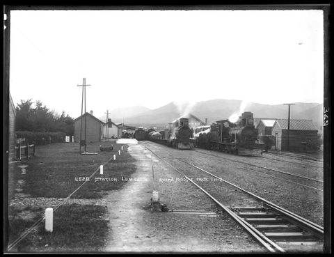
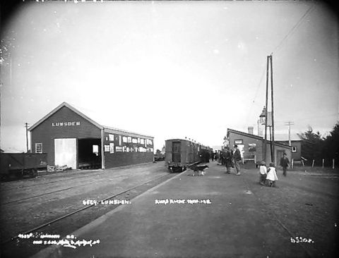
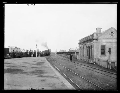
The Glenham Branch in Southland began at Edendale and ran to Glenham, a small rural locality at distance of 15 km. The branch was known as various names when being developed. The overall intention seems to have been to go further south than Glenham, to which the line was opened in May 1890. Wyndham at 6.5 km was the major community served by the line and became its terminus in July 1930. The extension to Glenham is somewhat similar to the Tokarahi Branch in northern Otago in that the earthworks done were quite extensive considering the very small population that was served by the development in its final form, and there must have been grander plans for both lines that were never realised. In the case of the Glenham line this took the form of a tunnel of about 300 metres length (as shown on Q4) which like the Tokarahi ones although long abandoned remains in good condition and still accessible today. The Wyndham branch as the line became in 1930 continued to operate until September 1962 when it was closed completely.
For our research one of the useful resources to be had from National Library is a 1925 cadastral map, some portions of which are shown below. In all cases clicking the thumbnail should open the full map in the browser.1925 is a useful date because the entire line was still open at that time. The bibliographical record for this map can be read here and there is also a link on that page to the online version of the map (“Archived copy”). From that we can see that the map is part of the NZMS13 series and that it was first drawn in 1902 according to the title. The map only really covers the Wyndham to Glenham part of the map but I haven’t yet looked up the map for the Edendale area.The second useful map of the area is the NZMS16 Wyndham township map published 1926 and first drawn in 1904. This is detailed enough to show us the layout of Wyndham railway station.
Glenh1 Glenh3
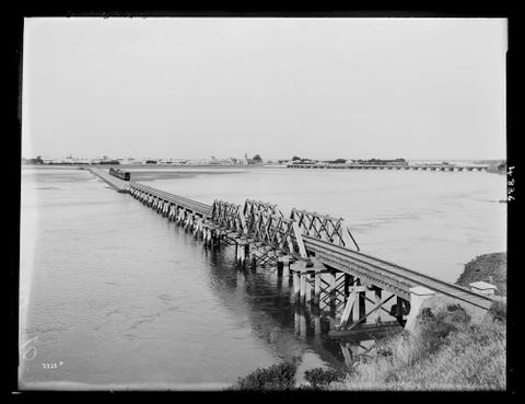
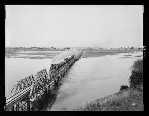
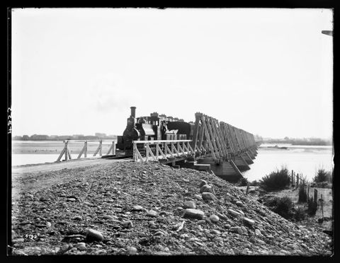
This extract shows the Mataura River crossing and the town of Wyndham. There is also a gravel reserve which possibly might have been used for ballast during construction. The Mataura bridge was separate structures for road and rail although there must have been a temptation to combine them given the size of the river.
Glenham railway station in the township. Street names today are quite different.
Glenh2 ghint2
Continuing on down we see the approach to the bridge across the Mokoreta River. Again we assume these were separate structures. The interesting point here is the land boundaries which imply a greater amount of land set aside in what would have been a useful location for an intermediate station (see next map).
So we can see in this present day map using the current land boundaries the way that extra land may have been provided for. We have no proof there ever was a station here but it is possible provision was made for one to be added later. But the historical map makes it reasonably clear there was no substantial population in the area and the closure of the line indicates it probably never paid its way.
Glenh4 Glenh5
The immediate vicinity of Glenham township where the railway at that time ended. Apart from the station we can see details of a school, post office, dairy factory and some other areas of land. The homestead is possibly the “Glenham homestead” referred to in official reports of the railway construction (AtoJs). Later maps (after the Glenham section closed) show there was also a school at South Wyndham near the tunnel.
The final point of interest in today’s post is the Glenham railway reserve south of the station. The AtoJs reports and other documentation suggests extending the line south was definitely contemplated. One of the line’s early names was the Edendale Fortrose Railway. Fortrose is on the coast south of Waimahaka, the closest point to it that was eventually served by a railway (Seaward Bush Branch). On today’s maps this corridor is still allocated by survey boundaries as far south as the side road where the widening suggests again allowance was made for a future station or siding.

Sunday 28 December 2014

NZ First’s 2014 “Railways of National Importance” policy platform [3]

Here are the last few bits of the programme and the statements of what Kiwirail should be structured as.
11. New suburban services
New suburban passenger train services will be investigated for Christchurch, Dunedin, Tauranga and between Hamilton and Auckland.
This includes an initial investigation into establishing suburban passenger train services in Christchurch, Dunedin, Tauranga and between Hamilton and Auckland using Auckland’s surplus diesel rolling stock immediately following the introduction of electric services in Auckland.

For Christchurch this could cost up to $200 million. There's doubt that Dunedin is big enough to warrant suburban train services being reinstated after a 35 year gap.

12. Rail siding grant scheme
New Zealand First will introduce a grant scheme to encourage greater use of rail transport by industry and by distribution centres, where the cost of installing or re-commissioning rail sidings will be met 50/50 by the businesses using the rail siding and the New Zealand Railways Corporation.
New Railways structure proposed by NZ First
KiwiRail would be restructured by splitting it into three new  organisations:
1. New Zealand Railways Corporation - owning and managing rail land, tracks and infrastructure, stations and rail-freight centres, shunting yards, workshops, train control systems, managing and maintaining the rail network, allocating access to the rail network for rail operating companies, setting rail training standards and qualifications, and acting as the rail regulator and licence agency.
2. Kiwi Rail - operating rail passenger services between all main centres, and operating the Interisland ferries.
3. Rail Freight – a new State Owned Enterprise operating a commercial rail freight business.
To have a commercial rail freight business implies open access or competition for rail freight operations. This will see the same challenges as currently occur in road transport where intense and rapacious competition between operators see safety standards widely flouted and accident rates increasing.

The overall impact of the policy proposals seems to have been limited. There was a policy announcement but very little actual reporting by mainstream media.

NZ First’s 2014 “Railways of National Importance” policy platform [2]

Now looking into more detail of various RONI projects.
1. North Auckland  and Marsden Point Line
Northland needs good rail connections to the rest of New Zealand if it is to grow. That means upgrading the Auckland to Whangarei line. Good rail links to Northland means developing a rail link from the main line to Marsden Point port, which has great advantages as a deepwater harbour that does not require dredging. There is also plenty of land for expansion.  There is great scope for it to serve as a container port and take pressure off Auckland and Tauranga. The potential of the Port of Northland for the region, as well as for the country as a whole, is being strangled by lack of an effective rail link.
2. Rolling Electrification Programme
New Zealand First proposes an on-going rail electrification programme to use the skills and expertise built up in the current Auckland suburban rail electrification project. The first project will be to extend electrification from Papakura to Pukekohe. Other potential projects to be investigated include electrification between Auckland and Hamilton, Hamilton and Tauranga, and extending electrification north from Waikanae and from Upper Hutt to Masterton. Many other projects for electrification would follow in later years:

- Lyttelton-Christchurch-Greymouth.
- Christchurch suburban area.
- Picton-Christchurch-Dunedin-Invercargill.
3. Regional Opportunities
Funds will be made available for smaller capital investment opportunities that KiwiRail is unable to fund given its current funding constraints.
In particular, $4m will be used reinstate the Napier –Gisborne line as soon as possible.

The long term costs of reinstating the Gisborne line are much greater than this relatively small amount for a one-off reinstatement. 
4. Cook Strait Ferries
The Cook Strait Ferry service and vessels will be funded for upgrades to ensure a high quality fast reliable and safe service for freight and passengers.
5. Auckland-Pokeno-Paeroa-Te Aroha-Tauranga-Whakatane
A new line to be built along the rail formation between Pokeno-Paeroa-Te Aroha, a new line to be built between Te Aroha and the western portal of the Kaimai tunnel and a new line to be built between Awakeri and Whakatane, all combined creating a shorter and more direct rail route into the Bay of Plenty.
The Pokeno-Paeroa line was never more than some formation works as it was never brought into operation. The same (small) saving in distance over the existing route to Tauranga could easily be achieved by the much cheaper expedient of moving the existing ECMT junction from Frankton to Taupiri. Awakeri-Whakatane is basically the old siding to the Whakatane Board Mills, but also needs the reinstatement of the Taneatua Branch to Awakeri.
6. Auckland-Hamilton-Tokoroa-Rotorua-Taupo
A new line to be built between Kinleith-Rotorua-Taupo primarily for forestry traffic, as well as for general freight and passengers.
7. Nelson-Blenheim
A new line to be built between Blenheim and Nelson, completing this long proposed project for freight and passengers.        
Nelson never had a through railway at any time in its history. 
8. Auckland International Airport
A new line to be built to link the Auckland International Airport with the rail system. The proposed new integrated terminal at Auckland (like that built at Christchurch International Airport) is already being designed to accommodate a rail terminal within the building.
Debate continues over the best railway system for Auckland. Light rail is a viable alternative as it is difficult to get airport passengers to use public transport.

9. Auckland City Rail Link
Build the Auckland City Rail Link tunnel project under central Auckland as soon as possible, jointly funded with the Auckland Council.
Already underway in Auckland City.
10. Northland
New lines to be built to link the rail system with ports in Northland between Oakleigh and Northport at Marsden Point, and Otiria and Opua in the Bay of Islands.
Marsden Point and Opua are two different systems. Opua is a much smaller port, why would rail to there be important.


NZ First’s 2014 “Railways of National Importance” policy platform [1]

This is the New Zealand First policy on rail development. Jon Reeves is a railfan of long standing having been involved in the Campaign for Better Transport and this policy appears to be squarely targeted at getting support and votes from the NZ railfan community and possibly the wider rail industry such as it exists in NZ. A particular feature of this policy is the retargeting of the terminology of Roads of National Significance into Railways of National Importance.
  • New Zealand First will ensure that none of New Zealand’s railway lines and other strategic railways infrastructure will be privatised, and will remain under state control and ownership to ensure that public service rather than commercial objectives is the paramount consideration.
  • New Zealand First’s vision includes passenger train services along all rail routes between the main centres, with connecting coach services linking outlying areas or running services between centres which don't have a railway line. These services would provide a mixture of accommodation standards and fares to make rail services more affordable for New Zealanders to use e.g. half the carriages to be high standard premium fare similar to that provided on current KiwiRail tourist focussed trains such as the Northern Explorer and Tranz Alpine services, and the other half of the carriages being basic, affordable economy fare intercity market, e.g. railcars would have one premium carriage and one economy carriage. The Silver Fern railcars, former Overlander carriages and Silver Star carriages could be appropriately refurbished and upgraded locally in railway workshops to operate daytime regional Intercity services. Fast modern railcars and new carriages, New Zealand built where possible, could later be purchased for certain routes.
  • As a state-owned enterprise, KiwiRail is currently heavily constrained because it is required to pay for the maintenance, renewal and upgrade of rail infrastructure through the revenue generated from its freight and other businesses.
  • New Zealand’s rail network is a national asset that must be developed to optimise its long term role in support of New Zealand’s economy and of an efficient and cost effective multi-modal and well integrated transport system.
  • New Zealand First will develop a programme of railways of national importance (RONI) to ensure that better use of our railway network and services are achieved, with improvements and extensions where there is opportunity to significantly reduce dependence on the roading network, especially for heavy freight and bulk freight services, but also where passenger services can be redeveloped to attract sufficient demand over time.
  • To this end New Zealand First will not require the whole cost of development of new railway tracks and services, and of electric reticulation, to be met by revenue generated by railway service charges; and these will instead be met in whole or in part by a combination of Land Transport Fund funding and crown grants.
  • The Land Transport Fund funding will be achieved by reallocating funding from the current RONS $12 billion plus programme. An initial budget of $400 million would be created by reprioritising Roads of National Significance (RONS) projects that have low or marginal benefits.
  • The rail routes listed below would form the basis of the core transport network between the main centres with daily passenger and freight services, and with the tracks being upgraded or new lines built as required, together with new transport interchanges between trains and buses, and freight hubs in all the main centres:
    • Auckland-Whangarei-Opua
    • Auckland-Pokeno-Paeroa-Te Aroha-Tauranga-Whakatane
    • Auckland-Hamilton-Tokoroa-Rotorua-Taupo
    • Auckland-Wellington
    • Wellington-New Plymouth
    • Wellington-Gisborne (via the Wairarapa line)
    • Nelson-Blenheim
    • Christchurch-Greymouth
    • Picton-Christchurch-Dunedin-Invercargill.

Saturday 27 December 2014

DERAILMENT NEAR EDENDALE

Evening Post, September 1935

Edendale, 1956

Another great view of Edendale in 1956 with the station, dairy factory siding and Glenham Branch all in view.
Edendale-WA-42505-F-FL13221296-1956

Lumsden Railway Station

Muir & Moodie, Te Papa Collections

Friday 26 December 2014

Edendale, January 2013

Google Earth images.
ed1
ed2

Edendale 1955

Edendale in 1955 with the Glenham Branch curving away to the east. Whites Aviation Collection, Alexander Turnbull Library.
Edendale-WA-38100-FFL13221346-1955

Waipahi 1962

A fairly clear view of the railway yard with the Tapanui Branch heading off to the north. (Whites Aviation Collection, Alexander Turnbull Library).
Click on this picture to see it full size.
Waipahi-WA-58725-G-FL12591195-1962

A VIEW OF RIVERTON, SOUTHLAND, SHOWING THEOLD RAILWAY BRIDGE, NOW USED ONLY AS A TRAFFIC BRIDGE.

Riverton Railway Bridge


Muir & Moodie

Thornbury

Muir and Moodie

Thursday 25 December 2014

Monday 22 December 2014

Rollins Pass and Moffat Tunnel

This is a dump from Google Earth and shows the difference between the two routes. The elevation profile shows the overall trend of the grade (numbers about the slope percentage should be disregarded as inaccurate). The summit at Corona also is where the green border line which comes in horizontally from the upper right of the map, can be seen crossing the railroad for the fourth time and then curving around to the north.
There are many Panoramio photos taken along the route and a number of points of interest. These will be expounded upon in a future article when this map will be presented as a full Google Map, allowing a more detailed examination of its various features.
rollins

Thursday 18 December 2014

Rollins Pass Railroad [4]

moffatmap
This map shows the original and later routes of the Moffat Road, as the railroad was originally called. I will have a GE map of the line put together in a few days to share.

Rollins Pass Railroad [3]

There is a very good book written in the 1920s that tells how the railroad came to be built over Rollins Pass. The full text is available online:
http://catalog.hathitrust.org/Record/001612260

Wahine memory

Bit of nostalgia here with an advert for the Wahine. It was only on the Lyttelton-Wellington run for less than two years before it sank in Wellington harbour in 1968. It was a bit odd that the Union Steamship Co persisted with steam fired machinery (oil fired boilers made steam to run turbines which generated the electricity for the propulsion motors) by this time because diesel-electric was a well proven technology used in the Cook Strait ferries and Union persisted with turbo-electric for their last ferry, the Rangatira, which was built in 1972. The problem was that running costs were higher for the turbo-electric system and this didn’t help the Rangatira in its last years which were in the middle of the oil crisis of the mid 1970s. Queen Elizabeth 2 was also built as a turbo-electric ship but mid-life its propulsion system was converted to diesel-electric which made it much more economical to operate.
Wahine

Wednesday 17 December 2014

Rollins Pass Railroad [2]

In my last post I mentioned the Riflesight Notch Trestle and whether it was a spiral. Turns out it was.
Riflesight_Notch_1903
This photo is from 1903 and it shows the tunnel at the lower level and the trestle at the higher level of the spiral.
800px-RifleNotch_centurylater
Same view a century later. The trestle still there although derelict, but the tunnel has collapsed.
Both photos from Wikipedia.

Tuesday 16 December 2014

Rollins Pass Railroad, Colorado

Well a bit of an international flavour as we approach this festive season.

Rollins Pass trestle (Devils Slide) from Panoramio, aiw0124.
The abandoned line over Rollins Pass was… originally built by the Denver, Northwestern and Pacific Railway, which was incorporated in 1902 to build a line west out of Denver to Salt Lake City, UT, on the opposite side of the Continental Divide. By this time, both Pueblo, CO (via the Denver, Rio Grande & Western) and Cheyenne, WY (via Union Pacific) had railroad lines heading west across the divide; it seemed logical that Denver should have one as well, and the DN&P was created for this purpose.
Construction on the line began in 1902, reaching the Continental Divide at Rollins Pass by 1903. By 1913, due to the difficulties of laying track in such mountainous terrain, the DN&P went into receivership and emerged as the Denver & Salt Lake Railroad, but it was for naught: construction on the line ultimately failed to reach Salt Lake City, only covering less than half the entire distance.
The climb over the top at Rollins Pass was fraught with numerous switchbacks, steep grades, and many instances of severe snow storms. These alone would seal the fate of the line over Rollins Pass, as the Moffat tunnel was built in 1928 to "replace" the tracks through the troublesome geography.
Today, the Moffat Tunnel is still in use by Union Pacific. The now-abandoned right-of-way over Rollins Pass branches from the UP line just east of the Moffat Tunnel's east portal, and then heads up to Rollins Pass via a series of switchbacks and tunnels. It then comes down the western side and meets back up with the active UP line at Winter Park. The entire abandoned route can be traced by following both Rollins Pass Road (on the eastern side) and Corona Pass Road (on the western side). (All text in italics is sourced from abandonedrails.com)
rollinswye
This GE image shows what appears to be an abandoned wye well up the Rollins Pass. This is only a small distance away from the trestle shown in the previous picture.

The “Needles Eye” tunnel has been closed for some years due to partial collapse of the tunnel roof. Panoramio photo from user Mike Bond.
rollinsge2
Here in another GE shot you can see how the railroad twisted and turned in order to keep a manageable grade on the climb over the pass. We can see double horseshoe curves in what is now a road, although the route is not completely passable due to the present day poor condition of bridging or tunnelling.
rollinsge3
Effectively this would be a kind of switchback although it doesn’t require reversal of the train as a true switchback would. It seems unlikely the railroad would have followed the hairpin bend in the road of today and instead it probably followed the big curve that is still visible at upper right. This is near the bottom of the pass and the active railroad that bypassed the route over the pass can be seen in the lower right corner of this image.
“Loop Trestle” as so described in Panoramio by user Elizabeth Haysmont. This is going down the other (western) side of the pass from that wye shown above. The road is called Corona Pass Road on the western side. Other Panoramio captions describe trestles in the same vicinity called “Rifle Sight Notch”. Most of these old trestles have been fenced off due to their dangerous condition. There was also a tunnel in the same area although I did not find a Panoramio photo of it.
rollinsge4
Rifle Site Notch trestle seen on GE.
rollinsge5
Not sure but possibly the Rifle Sight Notch was part of a spiral with the trestle going over a tunnel. I still haven’t seen anything to conform where the tunnel was. The line continued down the hill until it met the approach to the Moffat Tunnel.
slakingfool’s Panoramio photo of the Moffat Tunnel which was built in 1927 to replace the track over Rollins Pass. This 10 km tunnel took four years to build and has a very favourable grade of 1 in 125 compared to the 1 in 25 over the top. It is still in use today.


Thursday 11 December 2014

Onehunga: From Rags and Riches to EMUs


Good 20 minute video.

Wednesday 10 December 2014

Single lane for repairs on Mohaka River Bridge

Single lane for repairs on Mohaka River Bridge

4:20 PM Friday Nov 14, 2014
The Mohaka River Bridge on SH5 between Napier and Taupo. Photo / P0aul Taylor The Mohaka River Bridge on SH5 between Napier and Taupo. Photo / P0aul Taylor
An extensive maintenance and repair project on the Mohaka River Bridge on SH5 between Napier and Taupo is under way and will see a single lane and speed restrictions in place until the end of next month.
A speed limit of 30km/h has been imposed and will be in place continuously until then.
Temporary traffic lights have been set up as a single lane across the centre of the bridge has been put in place.
Heavy transport operators have been advised that the gross permitted weight for a single vehicle is 60 tonnes, with drivers requested to ensure there is a clear separation of at least 40m between crossing trucks.
Delays of up to five minutes can be expected.
Minor delays can also be expected on SH2 between Tutira and Morere where maintenance work is taking place at several sites on that stretch.
On SH2 south between Napier and Dannevirke work is also taking place at spots between Pakipaki and Waipawa, again with minor delays on the cards.
In Napier, on the stretch of SH2 at the Hyderabad Rd and Prebensen Dr roundabout, a new gas pipe is being laid near the Corunna Bay Rd southern intersection.
There will be single laning at times and delays can be expected, with contractors urging motorists to drive with caution and patience.
The work is expected to be wrapped up early next month.
http://www.nzherald.co.nz/hawkes-bay-today/news/article.cfm?c_id=1503462&objectid=11358571


Tuesday 9 December 2014

Rail corridor mooted as highway for $77m

Rail corridor mooted as highway for $77m
Thursday, December 4, 2014 by Andrew Ashton and the Wairoa Star
IF Hawke’s Bay Regional Council declines to lease the mothballed Gisborne to Napier rail line from KiwiRail, the council’s former chairman believes a proposal to turn the rail line into a state highway should be considered.
Wairoa farmer and retired politician Rex McIntyre wants today’s politicians in Gisborne, Wairoa and Hawke’s Bay to consider a $77 million proposal to create a road link that he says could save 15 minutes on the trip from Gisborne to Napier, and enable drivers to avoid the Devil’s Elbow section of State Highway 2.
Mr McIntyre, a spokesman for a group of businessmen from Hawke’s Bay and Gisborne, believes an alternative route to SH2 would allow wider loads and bigger freight machinery because it would avoid the rail overhead at Sandy Creek.
The first stage of the project would create 29km of road between Esk and the Tutira overbridge, while the second stage would create a further 3.8km of road around the Putorino area.
The proposal has been backed by the Road Transport Association.
Mr McIntyre said 30 percent of Wairoa-based food processor Affco’s stock came from Gisborne and the East Coast, and the same amount was sourced locally — while 40 percent came from Hastings and Central Hawke’s Bay.
“This new route would give the local employer a great economic advantage.
“The cheaper the road costs, the better the return to the farmer, which secures the Wairoa processing plant’s future.”
The project would also involve a $17 million 186-metre viaduct at Waikare, along with a total of three new bridges along the route.
It would be financed by a $12 levy paid by heavy vehicles at an automatic Waikoau toll bridge.
Mr McIntyre said because fertiliser could no longer be transported by rail, re-opening the line for rail use was not viable and estimated fuel savings from a shorter road between Gisborne and Napier would save all three regions $14.8 million a year.
“Taxpayers’ money would be put to better use on road maintenance, as today we are importing fresh produce rather than frozen and non-perishable goods, so it would be in everyone’s best interest because the roads are faster.
“Over the 43 years of the railway line operating, there was a loss of $150 million, which works out to be $3.5 million a year.”
As a former chairman of the regional council’s road transport committee, he had estimated that it would cost $10 million to bring the Mohaka viaduct up to standard for rail use.
“There are six other viaducts, so that just gives you an idea of the cost.”
However, the road link could also work alongside a cycleway that would benefit all communities between Napier and Gisborne.
The rail line’s owners, KiwiRail, last month agreed to lease the mothballed line to HBRC, subject to a number of conditions.
HBRC expects it to cost about $4 million to repair the line, which was mothballed in December 2012 after storms earlier in the year caused severe damage.
The council has until March 1 to accept the offer from KiwiRail.
http://gisborneherald.co.nz/article/?id=39690


Port to spend $12 million to enlarge upper log yard

Port to spend $12 million to enlarge upper log yard
Tuesday, December 9, 2014 by Murray Robertson
THE Eastland Group is about to start a major $12 million contract to construct the upper log yard extension at the Gisborne port and work will start in January.
The contract for the project has been let to Downer.
When completed it will expand Eastland Port’s upper log yard near Crawford Road by 1.3 hectares.
Eastland group chief executive Matt Todd says work is already under way to prepare the port for the expected six months of construction.
“The project will take the upper log yard’s footprint from 2.2 to 3.5 hectares, improving operations significantly for forestry customers
“It will take the total log storage area at the port to 12.2 hectares.
“The changes will also improve aesthetics for nearby residents and reduce potential issues such as noise and dust,” Mr Todd says.
“A four-metre by six-metre earth wall will be built around the perimeter of the site and planted with native trees.
“We have had extensive consultation with landscape architects to ensure anything planted is what Captain James Cook and Joseph Banks would have seen on Titirangi when they sailed into the bay.”
An internal fence will be entirely screened by the thousands of trees planted, he says.
The upper log yard expansion project is part of Eastland Group’s 10-year development plan and is one of the company’s biggest investments since it bought the port.
Log export volumes have grown from 350,000 tonnes in 2005 to 2.2 million tonnes in 2014.
“Log export volumes have been maximised under the port’s current footprint and configuration.
“Forestry is an industry that continues to grow, providing opportunity and employment for our whole region.
“Right now we have 95,000-tonne storage capacity on site and the expansion of the upper log yard will allow for an extra 15,000 tonnes.”
The flow-on effects are substantial, Mr Todd says.
“Forestry companies will require more workers, the port will need to increase its staff, and trucking companies will need more drivers.
“Generally speaking, for every new job in the forestry industry three other jobs are created in the local economy.”
Eastland Port manager Andrew Gaddum says Downer will start work as soon as possible to make the most of the summer months.
Fertiliser storage sheds and other buildings on the site have been removed in preparation, along with other buildings.
“This area will be levelled and a special base put down to ensure a solid footing for the tonnes of logs to be stored there.
“The redevelopment of the site includes a world-class stormwater treatment system, which is another significant benefit of the investment,” Mr Gaddum says.
“A small ridge on the site will be removed, but there will be no earthworks that involve any part of Kaiti Hill.”
The upper log yard will be closed for the duration of the construction period. “So there will certainly be an impact on day-to-day operations,” he says.
“The next six months will require a greater level of shipping co-ordination to ensure that log storage time is minimised and throughput is maximised.
“We will be working with our customers to reduce the inconvenience of having this log yard out of service, however it is likely the Matawhero log yard will need to be used for peak volumes over the period,” Mr Gaddum says.
“We will use the 2.5 hectare site we have Matawhero.”
The port company also has long-term plans to develop a storage area south of Tolaga Bay at some stage.
The consent process for that project has not yet started.
Mr Gaddum says the major construction project is right in the centre of the city, so there may be disruption to traffic and inconvenience to people in the area.
“Right now, we’re working flat-out to get this project up and running and we’ll work closely with Downer to do everything possible to minimise the impact on the city.”
The project will require significant local resource to complete in the tight timeframe, meaning a large portion of the money spent will go back into the local economy, he says.
“We look forward to working with Downer and its subcontractors to ensure the safe and successful completion of this significant regional project.”
http://gisborneherald.co.nz/article/?id=39749


MNL Tunnels 22, 24

tua1
First up the so called “Tunnel 24” just north of Tuamarina. Contrary to the NZ Railway and Tramway Atlas, alive and well as seen in this video frame from a passing train. There is in actuality no terrain over the top of this tunnel that would justify its existence, and it was not part of the original railway. The best suggestion is that it is an early expression of an overbridge constructed in a tunnel form which are now commonly seen around the countryside, although in no other case are they classified as tunnels, rather as bridges. State Highway 1 is carried over the top of the railway here.
20080103-140750_A450
Tunnel 22 is further south, at the summit of the Dashwood Pass. The two small-section tunnels (No.23, formerly No.1 and No.22 formerly No.2) from one of the earliest completed parts of the MNL, the Picton Section to Wharanui, were both daylighted in 1979 and 1981 respectively to bring the line up to modern rolling stock clearances. The Dashwood Pass is a spectacular section of the MNL and one of the major geographical obstacles on the former Picton Section, which was joined to the rest of the MNL only as late as 1942; there is also a major climb between Picton and Koromiko to lift the line over the “Elevation” at Mount Pleasant. In addition, south of Seddon the line drops rapidly down to Blind River. Tunnel 22 was the site of the “Dashwood Smash”, the 1966 derailment of a mixed freight-passenger train in which the locomotives jumped the track and collided with the tunnel; the driver in the lead engine was killed and his assistant seriously injured.

Oaro Tunnel

Tunnels 1-4 on the Main North Line are between Claverley and Oaro.
Tunnel No.4 in particular is about 1 km south of Oaro. It is one of a handful of tunnels that have been abandoned due to earth movement.
Oaro
The tunnel portal at the south end used to be a lot more visible than it is today. The northern end might still be visible on GE although it would take on-foot reconnaissance to verify exactly its position.
20080103-091850_A450 The south end tunnel portal as seen from beside the track. This used to have a gate over it and was relatively open. However in more recent years the inside of the tunnel has been filled in as quite a few stupid foamers have gone inside it. It is dangerous due to having collapsed from earth movement – the white soil is blue papa which is a soft mudstone that slips very easily. The actual date when it was abandoned isn’t well known but is possibly the early 1950s.

Hawkswood Overbridge (Main North Line)

The first image below is a frame from a video shot by a tourist who attached a GoPro type camera to a locomotive (as far as I can tell).
hawkswood
Just before the overbridge on SH1 we can see to the left and right the remains of the concrete abutments of the old overbridge here. This started out as a one lane concrete structure, probably in the 1930s or perhaps earlier as the exact date the railway north of Parnassus was built is not clear (it was not opened until 1939, to Hundalee). 
hawkswood
This map shows the changes in the highway including with the overbridge.
hawkswood2
In this map we can see the old section of highway north of the bridge. It consists of several sections:
  • The approach to the bridge from the south involved a short sharply curved section immediately west of the highway.
  • After crossing the bridge, Hawkswood Road descended on a zigzag to cross the Hawkswood Stream at a low level, to the east (the bridge was called the Cold Stream Bridge). This section is still used as a local road. On the present highway, Hawkswood Stream is crossed just north of the overbridge, by a culvert, which appears also to be the way the railway crosses it.
  • The road then climbed again and crossed over the present road heading towards Ferniehurst. A section of the old road is still in use as the access to Ferniehurst Railway Station, including the bridge over Chilly Stream.
  • The road then crossed over the present alignment again and finally met the current alignment again at Siberia Ford. This was an actual ford which is now bridged.
The highway realignments were two separate sections (Hawkswood and Ferniehurst-Siberia) and were built between 1999 and 2001.
coldstream
This is the old section of the highway (Hawkswood Road) with the road going down and right to the bridge then climbing back up on the far side to the left before reversing again and going to the right. The hairpin bend was a 35 km/h curve.
What is surprising about all of this is much larger trucks today are rated to go on the much worse highway over the Hundalee Hills without any thought of fixing up the highway at all.
The video clip below is the actual clip from Youtube that was used to grab the frame above.

Sunday 7 December 2014

Saturday 6 December 2014

Gisborne Photo News No.8, 24 February 1955.

NZRLS East Coast Rail Tour

GPN08_19550224_026GPN08_19550224_050aGPN08_19550224_050bGPN08_19550224_050cGPN08_19550224_050dGPN08_19550224_050e