Today’s part is fairly straightforward and will look at the Sibambe to Cuenca line. As far as I can tell this started to be built 1915 and was completed 1965, as it is only 145 km this seems like a long time to build a railroad and it was originally to be a private company. Well it is possible part of it was completed in 1965 and the rest (perhaps majority) had been open much longer, who knows?
This is not going to be a long article because today we don’t know much about this line because there weren’t many passenger runs on it latterly and possibly not actually a public passenger service, only excursions. I don’t know when they stopped running but one source on the web suggests the early 1990s, and how this might have come about, is not too clear either.
The Cuenca line joins onto the G&Q at Sibambe, which isn’t on Google Earth, but here is a Flickr photo showing the junction pretty well (thanks to Colin Churcher who has a huge collection of photos on Flickr, with an Ecuador tour set for 1988).
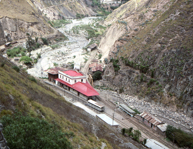
This is Sibambe which is the junction station. The Cuenca line goes on the left, with the G&Q line on the right. At the time Cuenca was still open. These days with the stop start fortunes of the railway, Sibambe is virtually abandoned. A lot of the other buildings looked to be in pretty bad shape by 1988.
By way of comparison this photo from 2005 is from Wikipedia:

You can see the difference. There was some sort of township around here once. I can’t quite work out where there was room in this gorge so maybe it was a little further away, unless all those other buildings were the township. The station building is roofless and virtually just a shell.
This recent photo from FEEP, the Ecuadorian State Railways (can’t link) shows that Sibambe station has been restored recently as part of the line upgrading works and it looks much tidier now.
The story these days (according to Michael Grimes on his Kells Bus Museum site) is that the Cuenca line has been closed by washouts and slips and is probably not going to be reopened.
Here are some more photos from Colin Churcher (limited because his tour apparently didn’t go very far down the line to Cuenca).
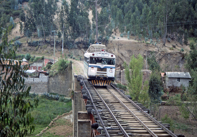
Crossing a bridge
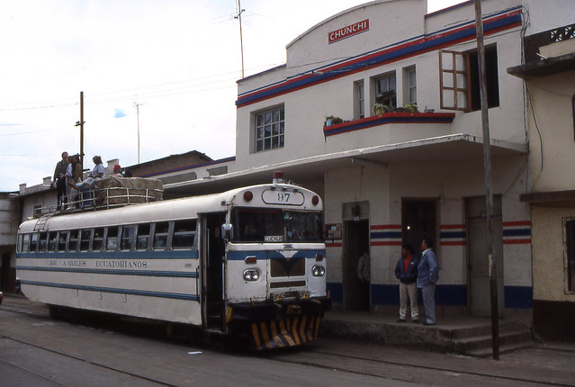
Chunchi station (not far from Sibambe)
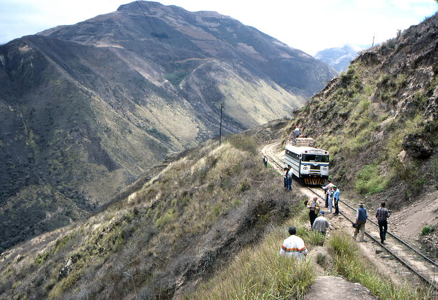
Near Sibambe. The line climbs quite steeply to get out of the gorge.
Now here is my map of the area in general:
View Larger Map
As you can see not much of the route is in brown colour, meaning there is relatively little Google Earth coverage, most of which is around Cuenca itself.
The table below shows some points of interest on the maps.
| View Larger Map | View Larger Map |
| Tambo station area with the wye. | Bridge on the outskirts of Cuenca. |
| View Larger Map | |
| Cuenca station yard. |
These days there is not an undisturbed route into the old station as the formation appears to be taken over in a few places by highway construction and probably the wastewater plant construction. As such you will see a lot of green line drawn around Cuenca due to the apparent formation route being obliterated and there not being any crossings of highway where it would have been needed. This is quite a contrast to some areas of the G&Q and San Lorenzo around Quito where highway crossings have been built as necessary in recent years, all this goes together to point to the closure of the line.
Now we have only the coverage of the G&Q itself for the rest of this series. I expect that will take at least a couple of parts, maybe three. Stay tuned.